عضویت
عضویت  ورود اعضا
 راهنمای خرید


visiondoc0 pages
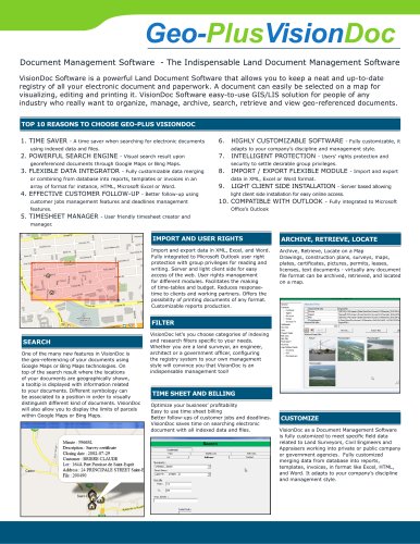
Geo-PlusVisionDoc
Document Management Software - The Indispensable Land Document Management Software
VisionDoc Software is a powerful Land Document Software that allows you to keep a neat and up-to-date
registry of all your electronic document and paperwork. A document can easily be selected on a map for
visualizing, editing and printing it. VisionDoc Software easy-to-use GIS/LIS solution for people of any
industry who really want to organize, manage, archive, search, retrieve and view geo-referenced documents.
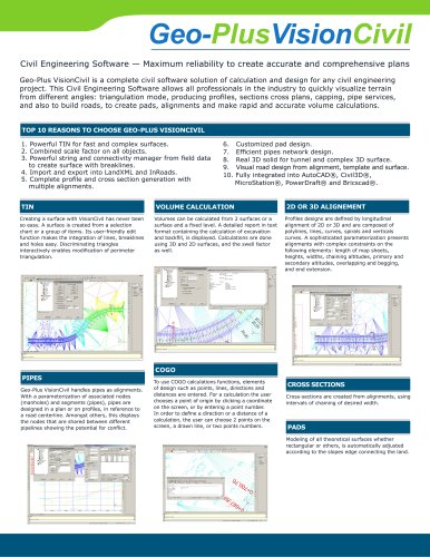
TOP 10 REASONS TO CHOOSE GEO-PLUS VISIONDOC
1. TIME SAVER
- A time saver when searching for electronic documents
6.
using indexed data and files.
2. POWERFUL SEARCH ENGINE
- Visual search result upon
7.
georeferenced documents through Google Maps or Bing Maps.
3. FLEXIBLE DATA INTEGRATOR
- Fully customizable, it
- Fully customizable data merging
array of format for instance, HTML, Microsoft Excel or Word.
4. EFFECTIVE CUSTOMER FOLLOW-UP
- Better follow-up using
customer jobs management features and deadlines management
features.
INTELLIGENT PROTECTION
- Users’ rights protection and
security to settle desirable group privileges.
8.
or combining from database into reports, templates or invoices in an
5. TIMESHEET MANAGER
HIGHLY CUSTOMIZABLE SOFTWARE
adapts to your company’s discipline and management style.
IMPORT / EXPORT FLEXIBLE MODULE
- Import and export
data in XML, Excel or Word format.
9.
LIGHT CLIENT SIDE INSTALLATION - Server based allowing
light client side installation for easy online access.
10. COMPATIBLE WITH OUTLOOK -
Fully integrated to Microsoft
Office’s Outlook
- User friendly timesheet creator and
manager.
IMPORT AND USER RIGHTS
ARCHIVE, RETRIEVE, LOCATE
Import and export data in XML, Excel, and Word.
Fully integrated to Microsoft Outlook user right
protection with group privileges for reading and
writing. Server and light client side for easy
access of the web. User rights management
for different modules. Facilitates the making
of time-tables and budget. Reduces responsetime to clients and working partners. Offers the
possibility of printing documents of any format.
Customizable reports production.
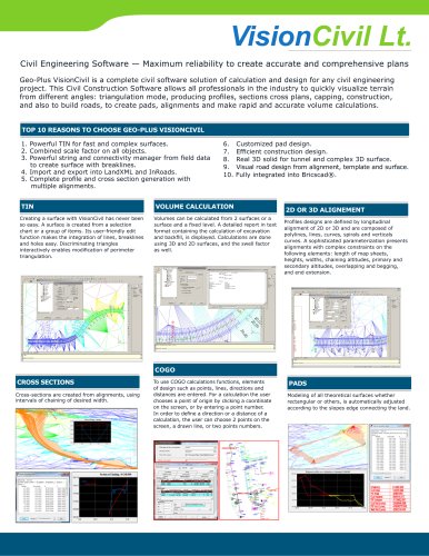
Archive, Retrieve, Locate on a Map
Drawings, construction plans, surveys, maps,
plates, certificates, pictures, permits, leases,
licenses, text documents - virtually any document
file format can be archived, retrieved, and located
on a map.
FILTER
SEARCH
One of the many new features in VisionDoc is
the geo-referencing of your documents using
Google Maps or Bing Maps technologies. On
top of the search result where the locations
of your documents are geographically shown,
a tooltip is displayed with information related
to your documents. Different symbology can
be associated to a position in order to visually
distinguish different kind of documents. VisionDoc
will also allow you to display the limits of parcels
within Google Maps or Bing Maps.
VisionDoc let’s you choose categories of indexing
and research filters specific to your needs.
Whether you are a land surveyor, an engineer,
architect or a government officer, configuring
the registry system to your own management
style will convince you that VisionDoc is an
indispensable management tool!
TIME SHEET AND BILLING
Optimize your business’ profitability
Easy to use time sheet billing
Better follow-ups of customer jobs and deadlines.
VisionDoc saves time on searching electronic
document with all indexed data and files.
CUSTOMIZE
VisionDoc as a Document Management Software
is fully customized to meet specific field data
related to Land Surveyors, Civil Engineers and
Appraisers working into private or public company
or government agencies. Fully customized
merging data from database into reports,
templates, invoices, in format like Excel, HTML,
and Word. It adapts to your company’s discipline
and management style.